


A couple of trips since my last report.
The trip over labor Day weekend meet with some tough conditions. Deep dropping was very difficult because of the Gulfstream current. Tangles were horrible and holding bottom was tough. I gave up on the deep stuff early in the day and went up top on the bank to chase from muttons, tunas and red groupers. We picked away but it was just a grind. Day 2 was more of the same. I tried a couple of drifts in the deep but that was still not working. So finished up on top chasing groupers and muttons. When the dust settled a couple of anglers filled up two 150 quart coolers each but they were the exception. They worked hard and paid attention to every detail to make that catch. I did find a customers report today. Please click here.
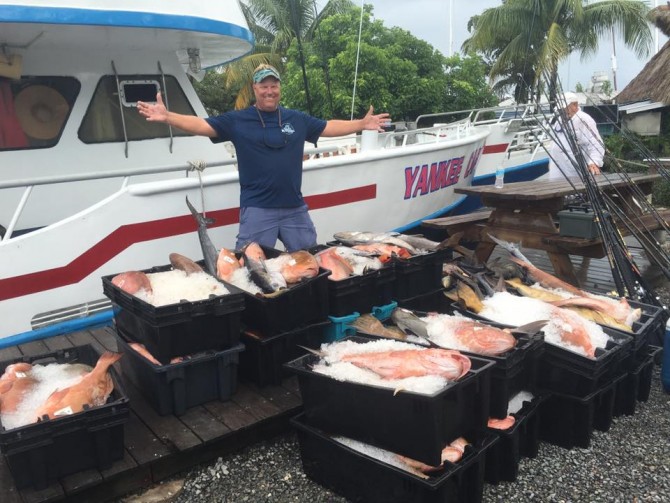
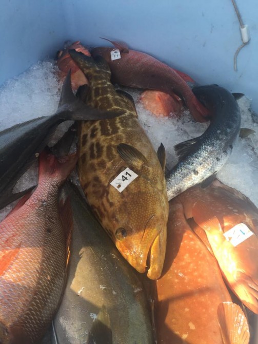
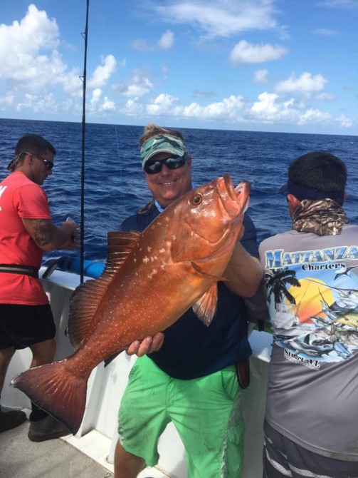
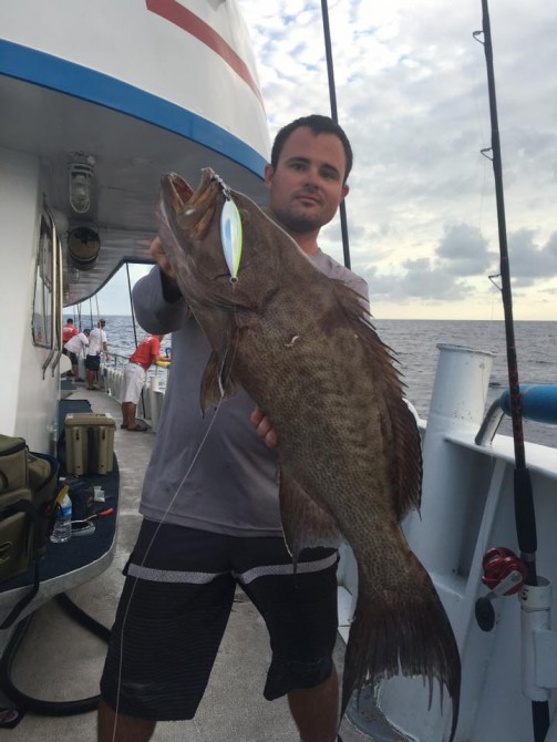
Our second trip of the week was a complete opposite. We did a quick turn around on Labor Day and headed right back to Pulley Ridge. I was concerned about the conditions after the last trip but my concerns were not well founded. Soon as we started fishing it was obvious the bite was on. In fact by noon of the first day we had more fish in the boxes than we did the previous trip. The bite stayed very steady until sunset, then it went cold. Sunrise on day 2 saw the bite start to tick again. By the late afternoon the back boxes were full as well as one of the front boxes. We had little ice left.
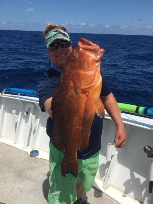
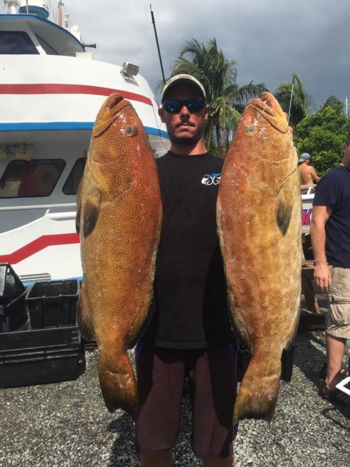
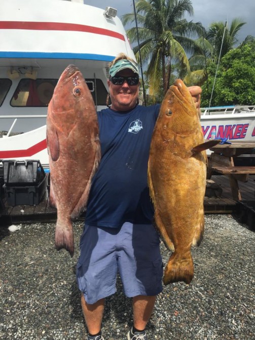
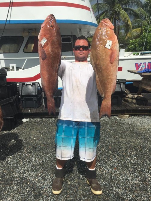
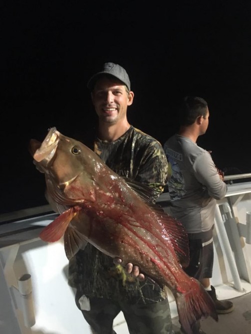
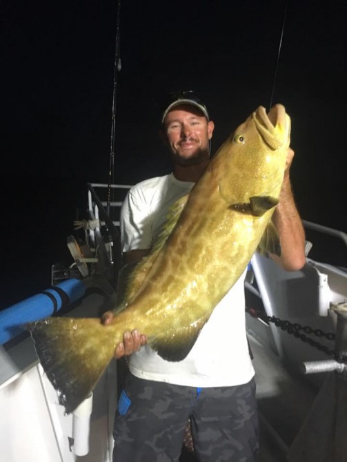
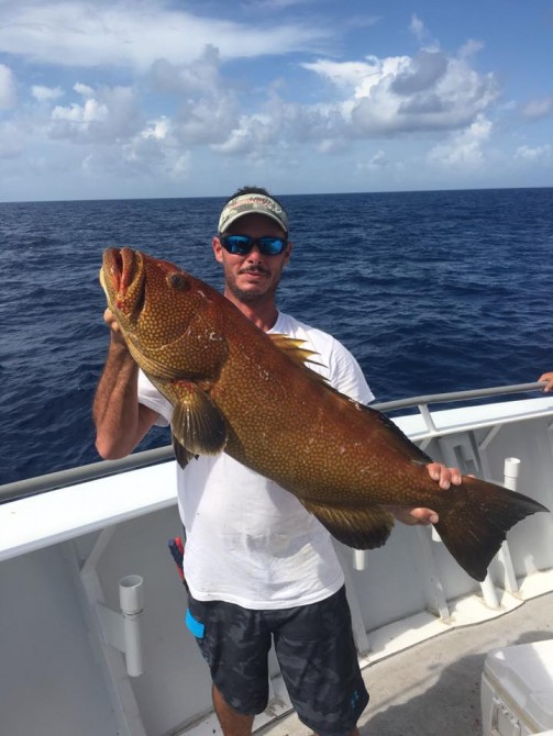
Pictures tell a thousand words so enjoy-
Lastly we are unfortunately tied to the dock this weekend. Angler participation was a little light so I had to call it. Today I received a e mail from our local NOAA forecast. After reading it the note it was apparent being on the ocean this weekend was not going to be very nice.
-
Hi everyone,Both wind and sea state across Florida Keys coastal waters likely will undergo rapid fluctuations from late this afternoon through Saturday, as a small low pressure area moves westward over the Straits of Florida.NOAA and Weatherflow Mesonet platforms along portions of the Florida Reef tract indicate that sustained winds increased to 20 to 25 knots earlier this afternoon, with occasional gusts near 30 knots. In addition, satellite-derived observations indicated a small area with winds sustained 25-30 knots in the vicinity of the Cay Sal Bank, along the eastern flank of the small low pressure area. This system is tiny, having evolved from the low pressure trough that was over the Bahamas on Thursday. Rapid changes in wind velocity are likely as it migrates westward across the Keys and Straits. Northeast winds are likely in advance of the system, with winds shifting to southeast as it passes. At present, Small Craft Advisories are in effect for the coastal waters of Florida Bay, Hawk Channel, and the Straits of Florida, east of the Seven Mile Bridge. However, some zones may need to be added and some dropped during the next 24 hours. Scattered, fast-moving showers, along with a few stronger squalls and thunderstorms will develop across Keys coastal waters from late this afternoon through Saturday night. Thereafter, typical mid-September rainy season weather is expected, with gentle to moderate breezes and a daily and nightly chance for showers and thunderstorms.Incidentally, specialists at the National Hurricane Center have indicated that the small low pressure area has a 40 percent chance of developing into a tropical depression through Sunday (i.e., a 60 percent chance of no development). We are NOT expecting sustained gale-force winds across Keys coastal waters. A few gale-force gusts (35-40 knots) are possible in stronger squalls and thunderstorms).Please consult the following sources for the latest marine weather information from your Florida Keys National Weather Service, in Key West, Florida:Florida Keys Coastal Waters Forecast:Hourly Weather Graphs for Florida Keys Marine Locations:Nearshore Wave Prediction System output:Smartphone widget:Best Regards,Chip K.
—
Kennard “Chip” KasperSenior Forecaster-Marine Program MeteorologistNOAA/National Weather Service1315 White StreetKey West, Florida 33040
So we have a unexpected weekend off. So some football and rest is in order.
Back out Monday night to Pulley Ridge. A limited load charter with nice forecast so far. Look for a report on Thursday.
Thanks for looking,
Greg